Tuesday, March 3, 2009

To Georgetown

Georgetown Latitude -- 23 deg 38.861
While we were at Staniel Cay. We learned our way around. We found the 2 grocery stores --- the Blue Store
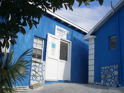
and the Pink Store. They have a lot of canned goods, some deep freezers of hard frozen various meat things, and a little fresh produce in the frig. Small dark rooms off someone’s house, lined with sparsely supplied shelves and old freezers. I also found the green post office, open by whim, but the lady at the Blue Store found the lady who works at the Green Post Office for me. She said the mail boat was late this week, as it’s substituting for someone else, but the mail would go out sometime next week. She took my postcards and money and promised to put stamps on them and send them on one of the mail boats, when I’m not sure. I am truly sure she will send them…curious to see when they arrive. We are going in to town in a few minutes and order bread (freshly baked by order) from the lady at the Yellow Store. Keeps it simple!
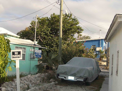
Last night we joined friends from 3 other boats at the Thunderball Club.
The 8 of us were all that were there. They are supposed to have Happy Hour from 4-6 “but the boat didn’t come in so they were out of the cheap rum that is used for the cheap drinks and coconut cream” so the waitress didn’t know if there would be Happy Hour or not. BUT! The manager stepped in and agreed to let us have Happy Hour using half-cheap rum instead and lots of pineapple juice.
While we waited for that managerial decision, we wandered down to the Pirate Trap Beach. I’m not at all sure what this used to be.
Here is Luke playing pool with Carla. This is the table that Sean Connery used (there’s only 1…) when he was here filming Thunderball or Never Say Never Again.
Giggle.. they are calling for the lady who has the laundry tokens on the VHF right now. Somebody wants to do laundry and can’t find her. Wonder what color that building is….
The wind is roaring, but it’s warm, still in the 70’s. We’re doing more chores than planned. A little problem with the generator (that makes electricity for us when we’re not running the engine, along with hot water. Very important for showers!) I think Luke has fixed the problem.
On the 24th we had a great sail for the 7 mile to Black Point. Black Point is the largest (300 people) settlement in the Exumas. It’s another day in paradise….
This settlement has a clinic (pink building)
There is still a lot of poverty. Newer concrete houses, with the old ones just falling into complete ruins beside them. No place to throw junk, so it’s just left.
There are also a couple of restaurant and, the best laundermat in the Exumas (10 machines!!!! At a mere $3.50 per load…). The laundermat even has its own dock.

There are a few grocery stores . One restaurant, Loraine’s, also maintains an internet site for the cruisers. It’s free but requests a donation. Here’s Luke, checking e-mails.
Loraine also has a buffet on Wednesday nights. $17 for conch fritter appetizers, spicy chicken, ribs, grouper fingers, slaw, rice, steamed veggies, and a little square of pound cake for desert. She has the obligatory rum punch drinks, too. I watched her make them -- - a huge 2 gallon jug of something like Tropicana punch, ½ cup of sugar, and a splash of run. just a splash. This is a big cruiser gathering place. She had 22 of us there for dinner, really filling up her restaurant. I think there were 2 seats left. We met with friends Grey & Marian and Joanne & Paul.
We went beach combing with Marian & Joanne on a trash loaded beach, but one that had good sea glass beach with lots of shells, too. I guess the rough water wash up all sorts of garbage, plastic as well as glass. We also found a blow hole. Unfortunately, I didn’t catch it moments after this picture was taken of Paul peering into it.
The next run was to Little Farmers Cay. This is a small community of 55, all descendants of the original woman and her kids who settled this island.
We walked around the island and found JR’s Woodcarving. Self taught, he uses local wood and chooses his designs around the colors in the wood. I bought a Bahama Mama, a lady with an “onion knot semi-feral” hairdo.

See those 2 triangles of hair on the left side? If she had 3 triangles of hair she'd have a "full feral" hairdoo.


On our way to the local bar, we passed this …. Any takers?
There are 20 children in the “All Age School”, grades 1 -9. This is the system in all of the Bahamas except Nassau. If a child wants to go to high school, they must have a relative who lives in Nassau who will take them in so they can go to school there. Many don’t, so their education ends at grade 9. Sad, isn’t it?
We met up with other boater friends on our walk, and ended up at Ocean Cabin bar for a drink.Next stop, Georgetown. We had a “brisk sail”. Some boaters beside us took pictures of the boat underway. We don’t often get pictures of her actually sailing.
Georgetown is the mecca for many cruisers. Lots of cruisers leave the USA early in the season, head straight for Georgetown, find a spot to anchor here, and stay for the entire winter. It’s a large settlement, filled with up to 400 boats. We’ve been told there are about 350 boats here right now. There’s a wonderfully large grocery store, stocked with fresh foods and items I haven’t seen in a month! Georgetown also has free water, but only a few 5 gallon jugs at a time. The dinghies line up in the morning, jugs in the dinghy, waiting for their turn to fill up the jugs and tote them back to the boat. We think we can buy internet later at a small marina. One popular beach is Volleyball Beach, named for the nets on the beach. It’s a popular beach, complete with a bar.


Here is where I am right now, working on my e-mails and blog. $10 a day, must be here, but I'm glad to find it, as are many other cruisers.


Here's my spot, the next to last chair on the right.


We are enjoying Georgetown. I see why folks stay here for a while. Luke is at a wireless communications meeting on Volleyball Beach while I work here.


Tomorrow is 1) my 61 birthday! What a way to spend it! and 2) a big sailboat regatta parade of boats plus the associated activities. We'll have more pictures later, I'm sure, especially as we stay here and have internet.

Sunday, February 22, 2009

Cambridge Cay and Staniel Cay

Latitude 24 deg 10.50N
To give you a prospective of that, Deltaville is 37 deg 55.48 and our furtherest point north in Maine was 44 deg 48.68. The Tropic of Cancer starts at 23 deg 5, with the equator at 0 degrees. We MAY get as far as the Tropic of Cancer... not sure yet :-)
After leaving Warderwick Cay, we made a short, “brisk” sail to Cambridge Cay, still part of the Exuma Land & Sea Park. We took the outside route, via the Exuma Sound rather than the inside Exuma Bank. Probably a mistake, as it was pretty rolly, especially in the "cuts", the passages from the bank side to the sound side, but we made good time and got there in only 3 hours.

It was windy (18 to 22 kts) and cool at Cambridge Cay, so we didn’t snorkel, although it’s supposed to be one of the best areas. Instead, we took the dingy to the beach and walked a trail took us to the bay side of the park, to Bell Rock. The protected bank side was fairly calm and quiet. Here is our anchorage area, with a pond in the island in the foreground.

The Exuma Sound side was definitely rougher.

Bell Rock is huge, with a hole in it. Here we are, in front of it.

The trail to the top of the ridge on the island was steep, but good exercise.

Today we make the short (2 hr) run from Cambridge Cay to Stanial Cay. Stanial is a populated cay, with a “yacht club” (aka bar), gas and diesel, water, a nurse, internet (again, $10 for 24 hours) and a phone relay station. Cute cottages for rent, too.

They also have nurse sharks, right here at the marina docks. We saw 6 of them swimming together – here are 4.
Look at this sneaky one… lazing under a boat…I think they actually like the shade. I think they are pretty hamless, but we definitely didn’t want to fall into the water as we got in our dinghy.

We also saw a big eagle ray, about 4 feet across, in about 2 ft of water.

One big draw at Stanial Cay is Thunderball Grotto. Remember the old James Bond movie, Thunderball? Yulp, same one ! It was shot here in 1964. Thunderball Grotto is a cave half under water, half above, that you can snorkel into. Just go in at low tide and there are holes in the rock above that allow light to flow in. Lots of fish and coral life. Luke snorkeled into it, but I passed on it. Here is the grotto. The main entrance is on the other side, where the dingy is headed.

I mentioned “reading the water”. A lot of the water area here is uncharted, meaning you’re on your own to watch for depth and coral heads. Here is a good example of reading the water. Starting on the left side, the green water is over sand, probably too shallow for us. Light yellow-green is very shallow, probably about 2 ft deep. Light green may be 5 to 8 ft deep. The boats anchored over the light green are shallow draft boats, probably with only 2 ft or so under them. The next, darker area is full of grass, rocks, and a little coral. Very questionable, but deeper than the green. The far right blue water is deeper,about 12 feet, and good for us to transit and anchor in. That is Thunderball in the background.

We will be here several days, probably until Thursday. The weather forecast is for high winds (20-25 knots) and storm squalls. Not good stuff to be out in. We are sheltered here and will be fine.

Friday, February 20, 2009

2 more days at Warderwick Wells Cay, Exumas Park Headquarters

24 deg 23.609N (our lowest latitude yet!)

76 deg 37.972W

We spent 2 more wonderful days here. Thursday we went for a loooong hike across the island. Didn't make it the whole way. We climbed to the top of one the highest points for a wonderful view. First, one direction...

Then the other direction...


We climbed down the other side of the hill and made the very smart decision to walk around the "mountain" instead of back up & down, through the water, and back to the boat.


Wickie was thrilled to see us when we got back....


He's slowing down. Eats, begs for more to eat, washes, and sleeps. Mostly sleeps. He's not as interactive anymore, but he does still love his daddy's lap occasionally. And the voice of a new person to the boat always bring him up to see what's going on - still a curious cat.


Yesterday evening some of the cruisers instigated a potluck party at the ranger station on the beach. Almost everyone came and brought food. It was fun. I learned to bring my own dishes and silverware; didn't think about that and a good soul had extras. We're learning!


Today we decided to take a dingy ride around the island instead of hiking. It was long and beautiful. First, another isolated beach to wander on, Loyalist Beach.


Then around the point into the bay. The rocks are much higher and windswept/water washed on this side. Constant waves will do that!


We did a little snorkeling from the dinghy - Luke saw a big ray in addition to the usual fishes and reef life.


And a final treat--- there a dozens of little finch like birds here, hanging around the ranger office, all addicted to sugar. They beg for it, come to the boats for it, and will swarm to any hand holding it. It 's so cute, but they probably all die from diabetes at an early age! I had 12 birds in my hand at one time. Luke easily had that many.


Tomorrow (Saturday, Feb. 21) we plan to leave with several other boats to go to Cambridge Cay. Supposed to be beautiful -- surprise! We won't have Internet for a few days, so I'll be back when I can!


Thursday, February 19, 2009

Exuma Cays Land and Sea Park

We enjoyed our stay at Highborne Cay marina. I just love the Bahamas – look at this stop sign.

We took a walk around the private island that the marina is located on. The bay side, across the island from the marina, is beautiful beach and mangrove trees and palms.


We found this little guy. He’s taken over one of those tree snail shells, the same type as the one that decided to climb up my curtain.


The marina itself Is small, catering mostly to larger motor boats. There were only 2 sailboats in the marina.
After we left the marina, we sailed about 3 hours to Shroud Cay, one of the northernmost cays in the Exuma Cays Land and Sea Park. The park was established in 1958 to preserve and maintain the delicate ecological balance on the marine life. It is about 22 miles long, comprised of quite a few small cays.

They are all protected, no fishing, collecting of conch or lobster, no taking of any live or dead sea shells. The park offers several areas that have moorings to use instead of anchoring. Dropping an anchor on the top of a coral reef can do a lot of damage. We used one of the moorings provided at Shroud Cay, although there was nothing but sand underneath. It’s only $20 to use a mooring.
Luke has climbed the coral rocks to the drop box for our payment… OSHA would be screaming…


We made our way carefully along the coral rocks to the top of the island, following a sign that said “well”. There IS a well here, along with a bucket tied to a mangrove tree. The wall around the well was done in 1927, according to the scratching in the concrete. We dropped the bucket in to check the water – yes, it’s salty. I read later that the water “layers” here, similar to the cave we visited in Lucaya. The seawater comes up from the ocean, but in the spring, when there is more rain, the non-salty rain water collects on the top of the salt water. I’m guessing it takes an experienced hand to skim off the fresh water from the salty.


Next stop, Warderwick Wells Cay, the headquarters of the park. You can not anchor in this area, only use one of the park provided mooring balls. It’s small, with 21 mooring balls in the main mooring field. Because of the uncertainly of weather and boating, they don’t take reservations, but have a selection system of their own. If you want a mooring, you call the office the day before you want to be there to get put on the “list”. Full almost every night, there is a 9 AM call-in each morning. First, the boats that are leaving that day call in on the VHF radio. Next, the ranger calls out each boat that is on the list, asking if they still want a mooring and confirming their length and draft. Then anyone else who hasn’t “pre-registered” puts their name on the list. The ranger signs off and does the math, juggling the number of moorings available and putting boats into them, ones that match the length and draft requirements of each mooring ball. It’s very shallow and narrow, so the moorings are not equal. After about 30 minutes, the ranger calls back out on the VHF, calling each boat by name in the order in which they were on the list. Now, there are are 3 mooring fields in the park. The treasured “northern mooring field” which is right in front of the park office, has easy access to the beach and trails, and for most boats, allows on-board internet service (rather than having to sit on the office porch). The northern mooring field is where we are. We were lucky.


Each boat is either given the guarantee of a mooring ball in the northern field or given the option of taking one of the other mooring fields. Without exception, the boats that didn’t make the cut opted to be put back on the list for the next day instead.

As soon as we got here, we signed in and started exploring. There is a trail that goes across the island from the bank side to the bay side of the island. This is again a coral rock trail.

It goes across Banshee Creek, dry in the low tide, flooded at high. Thank goodness it was low tide.

Past Banshee Creek, you climb the other side of the island to beautiful views of the bay.


This is looking towards the bank side, showing the rest of the island.

At the very top of the island is Booboo Hill. A boatload of missionaries crashed here, drowning all of them. Legend has it that the hill is haunted and at night, you can hear them singing hymns in the distance. Boaters leave a piece of wood (preferably driftwood) with their boat name as a gift, trying to ensure safe seas.


Also at the top is a blowhole. Look carefully --- Luke’s hat brim is blown up and flat, and the sleeve of his yellow shirt is blown up. We watched it literally blow the baseball cap off one guy.


Snorkeling is supposed to be wonderful here, but the water temperature is 74, and I’m sorry, that’s just a little too cold for me.
There is a nice porch on the ranger station, where folks gather to talk. Just look at this view. Another day in Paradise! That's Latitudes, closest.