Off to NYC today! But before I get into that, I have 3 more "going through NYC" pictures. Mimi and Otto's daughter, Eve, lives here and took some pictures of us going through NYC. Luke's family came from Belgium about 65 years ago, via ship, and landing in NYC. Here is Latitudes in front of Ellis Island, the gateway for many immigrants, before Luke's time.
We sometimes fool ourselves into believing that Latitudes is kinda big. She isn't - especially compared to one of the Staten Island ferries!
And Latitudes and Best of Times going under the Brooklyn Bridge.
New York! First, you take the dinghy to shore. Then you walk the 25 minutes uphill (not kidding...) to the train station. THEN you get on the train and head out of town for the 40 minute commute!
We're here! One direction to the Freedom Tower, the other to the 9/11 Memorial.
And finally, The Freedom Tower.
There were 3 things I REALLY liked about the tower - one was the 101 story fastest ever elevator ride to the 102nd Observation Tower floor (60 seconds), the second was the 101 story fastest ever elevator ride down to the 1st floor, and the third was, of course, the view. Videos were shown on the elevator rides - a geographical history of NYC on the way up, and the ride down was a video of the view you would have if the elevator was glass. The view from the Observation Tower, all 360 degrees of it, was spectacular. You really appreciate how densely populated and crowded the city is.
Look carefully and you can see Latitude's route into the city. At the upper center-right-ish, you can spot the Verrazano Bridge that we sailed under. To the far right, just out of sight is the Statue of Liberty. Past there, past the big ships, and a curve to the left, and we're outside of Manhattan, starting up the East River.
Here are 2 of the bridges we sailed under.
The 9/11 South Tower Memorial from the Observation Tower. The two memorial pools are set within the footprints of the two towers. Actually, the towers were a little larger than the pools. Both pools and the associated grounds are the "roof" of the 100,000 sq ft 9/11 museum, 7 stories under ground. The odd shaped white building is the entry to the museum. We couldn't get tickets to the museum - sold out until July 19...
Here is a nice link
http://www.wtc.com/memorial
Heat/air conditioning duct work surrounds the windows. I guess to keep folks from sitting or standing on them, they are all covered with little skylines.
A hot dog for Luke and we were ready to go out into the just beginning rain to see the 911 Memorial.
I couldn't get an entire pool in one picture. This one shows the inner infinity pool and the 30 ft high waterfall along the side.
This picture shows the names of the almost 3000 people who died that day. In all of that horror, an amazing 15,000 people escaped the twin towers and survived the attack. If it had not been for several twists of fate, the number would have been much higher - a big baseball game had been held the night before and lots of folks had taken the day off, it was the first day of school and parents were late because they were getting kids to school, etc.
A volunteer group places a white rose on each name on their birthday. We didn't get a picture of that.
From the Memorial, you can also see the new Oculus Building - actually an ultra modern train station.
$2 billion over budget now, it is not quite finished.
And did it ever rain.
To escape the rain after our Memorial tour, we ducked inside the newly renovated Brookfield Place. You can't really call it a "mall" because they also have events, but they certainly have some high-end shops! Plus a grocery shop that would put any gourmet grocer to shame. Beautiful veggies? I don't think I've ever paid $7/pound for tomatoes. Or $190/lb for pork...A view of the Hudson River and palm trees from Miami complete the opulence. A link https://brookfieldplaceny.com/
And who do ya call outside of the mall? Ghost busters!
NYC is wonderful - walked from the mall to the subway and to Penn Station entirely underground and dry. The rain was just letting up when we arrived so we did a quick street view of the city before catching the Long Island Rail Road back to Port Washington.
It was sunny by the time we got off the train. Timed it perfectly to miss the rain and the upcoming "big blow" to get back to Latitudes. The big blow did indeed start just as we got back. It has blown ever since about 5 and looks like it will continue through tomorrow. Right now the wind is howling at a sustained 22 knots with gusts over 25. We are rocking and rolling. But we are on a good mooring ball so we don't have to be concerned about our anchor dragging. AND! our engine part came in so Guido will be by around 9 tomorrow morning to do the repair. If the winds subside, we possibly continue our trip on Friday.
Wednesday, June 8, 2016
Monday, June 6, 2016
If it's 4:30 a.m., we must be going to NYC
Up way too early, at 4:30 a.m.! We had to have a 5 a.m. "anchor up" in order to hit the currents in the right direction to cruise through NYC this morning. I have to admit, I was amazed at how light it was already at 4:45. Don't want to discover that again any time soon....
Shortly after we left Sandy Hook, we could see the Brooklyn skyline in the early morning haze.
A fast ferry passed us on his way to NYC, taking in early commuters.
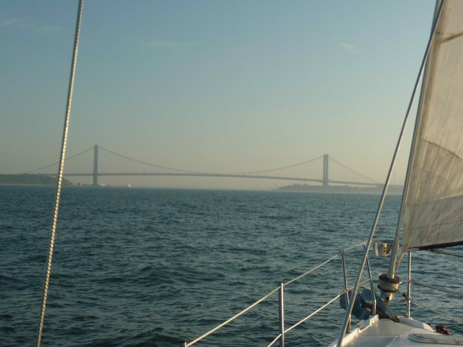
In the distance, the Verrazano-Narrows bridge, linking Brooklyn and Staten Island. The toll? $16. I feel like we're in NYC when we pass under this bridge.
A large container ship dock is located shortly after you pass under the bridge. This ships are big!
Latitudes and Best of Times are heading into the city!
The sun came out just as we neared Manhattan. The Freedom Tower is almost clear of the clouds now.
Past the ferry terminals - the old and new. Interesting how ornate the older one is and how basic and "modern" the newer one is.
A better view of the Freedom Tower and Manhattan as we approach the Brooklyn Bridge.
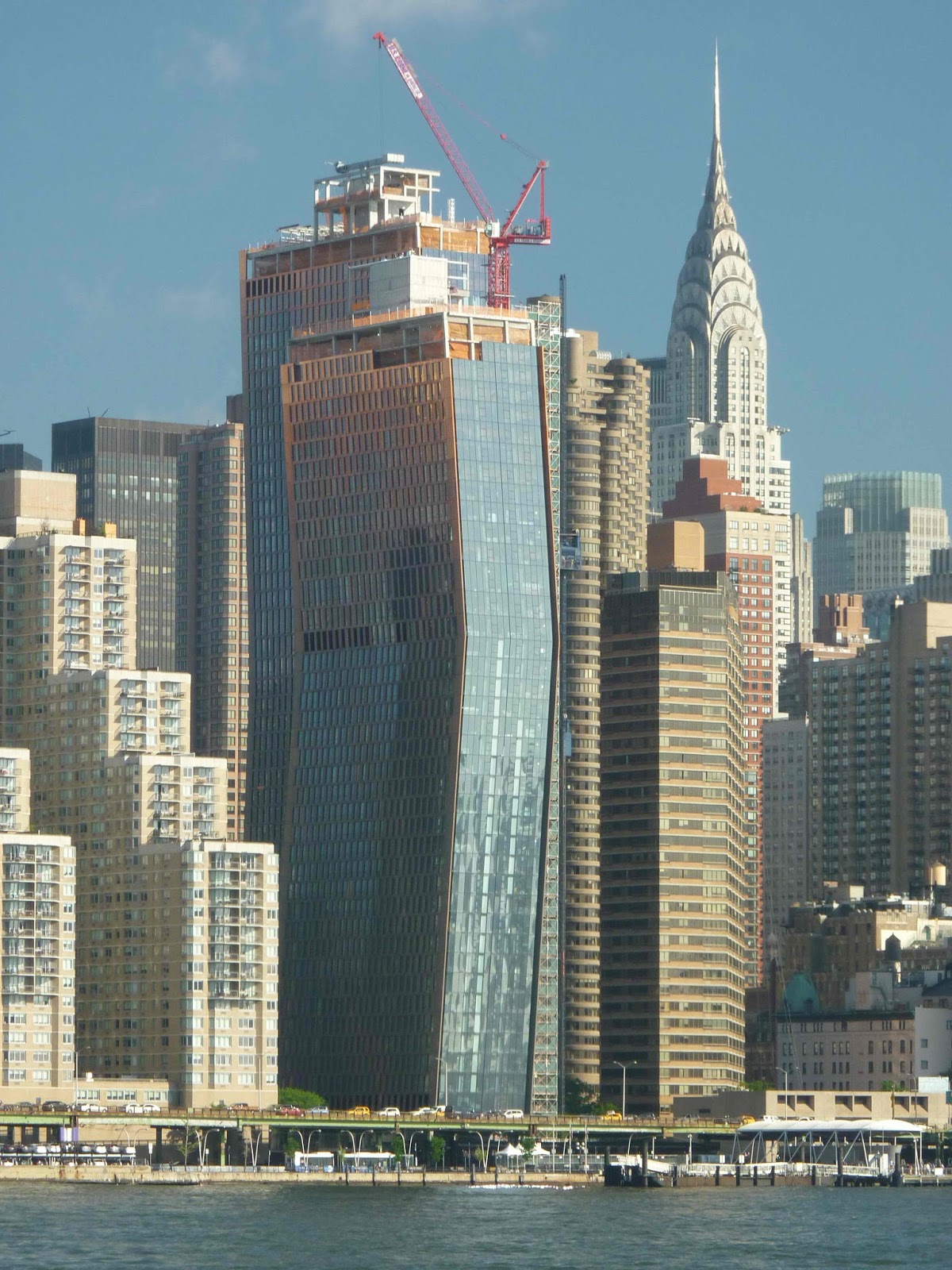
A couple of unusual buildings....
This one has a view of the Chrysler Building also.
Of course - the Empire State Building! Where is King Kong when you need him? Instead, here is more of the endless building and rebuilding.
And just how tall is the Freedom Tower? Besides 1792 feet to the tip? The 4th tallest building in the world? THIS tall....
The UN Building, with the Chrysler Building in the background left (that building sneaks into a lot of pictures...)
One of the critical timing issues for us today was our very swift and short shot through Hell Gate. Hell gate is a fast, furious watery nightmare if you don't time it correctly. Even going with the current, it's a trick.
The current through Hell Gate is about 6 knots, bringing our speed up from the usual 6.5 knots or so to a screaming 12.5 knots per our GPS! Yes, for a sailboat, that's screaming fast. "SOG" means speed over ground.
Smokey was so relieved after we zipped through Hell Gate and back into flat water, that she wandered outside to stretch her legs and view the world. She often just sleeps, with one watchful evil eye on us, during trips.
Less than an hour later, we are in the quiet waters of Port Washington, a really cute town with lots of things to do (like laundry, groceries, coffee, restaurants, and a 40 minute train ride to Grand Central Station). We will be here a few days.
A few lucky folks have some summer "cottages" along the waterfront.
But, as we sailors like to say, we have the same view, but we can change it if we don't like the neighbors!
Shortly after we left Sandy Hook, we could see the Brooklyn skyline in the early morning haze.
A fast ferry passed us on his way to NYC, taking in early commuters.
In the distance, the Verrazano-Narrows bridge, linking Brooklyn and Staten Island. The toll? $16. I feel like we're in NYC when we pass under this bridge.
A large container ship dock is located shortly after you pass under the bridge. This ships are big!
Next, the Manhattan skyline in the haze. That really tall building with the top above the clouds? The new Freedom Tower.
One of the many Staten Island Ferries zipped past us.
Up close and personal with Miss Liberty.
And her glowing flame.
The sun came out just as we neared Manhattan. The Freedom Tower is almost clear of the clouds now.
Past the ferry terminals - the old and new. Interesting how ornate the older one is and how basic and "modern" the newer one is.
A better view of the Freedom Tower and Manhattan as we approach the Brooklyn Bridge.
A couple of unusual buildings....
This one has a view of the Chrysler Building also.
Of course - the Empire State Building! Where is King Kong when you need him? Instead, here is more of the endless building and rebuilding.
And just how tall is the Freedom Tower? Besides 1792 feet to the tip? The 4th tallest building in the world? THIS tall....
The UN Building, with the Chrysler Building in the background left (that building sneaks into a lot of pictures...)
One of the critical timing issues for us today was our very swift and short shot through Hell Gate. Hell gate is a fast, furious watery nightmare if you don't time it correctly. Even going with the current, it's a trick.
The current through Hell Gate is about 6 knots, bringing our speed up from the usual 6.5 knots or so to a screaming 12.5 knots per our GPS! Yes, for a sailboat, that's screaming fast. "SOG" means speed over ground.
Smokey was so relieved after we zipped through Hell Gate and back into flat water, that she wandered outside to stretch her legs and view the world. She often just sleeps, with one watchful evil eye on us, during trips.
Less than an hour later, we are in the quiet waters of Port Washington, a really cute town with lots of things to do (like laundry, groceries, coffee, restaurants, and a 40 minute train ride to Grand Central Station). We will be here a few days.
A few lucky folks have some summer "cottages" along the waterfront.
But, as we sailors like to say, we have the same view, but we can change it if we don't like the neighbors!
Saturday, June 4, 2016
A little of Cape May and on to Barnegat Bay
Laundry, sight-seeing, groceries, and a haircut for me! It was a good stay in Cape May.
Boats, boats, everywhere.
Lots of cute (and expensive) old houses in the old section of Cape May.
And a few mansions (VERY expensive, if you could even get anyone to sell one)
We loved this birdhouse on one of the many picket fences.
This old church sits at the entrance to the pedestrian walking mall in Cape May.
Here is a view of the mall.
Mimi and I are standing outside of Congress Hall, a very old, nice hotel in town. I had just gotten directions to a beauty salon to get a hair cut (a 45 minute walk, but worth it!)
I got the haircut, everyone else went to the grocery store for a few items, and we ended our stay in Cape May.
Yesterday we left and motored to Barnegat Bay, about 70 miles northward, up the coast. The Atlantic waters were rolling and the fog rolled in, too. Atlantic City, in the fog.
Barnegat Lighthouse stands proudly at the inlet entrance. She is the tallest lighthouse on the eastern Atlantic north of FL. The original lighthouse was built in 1834, and the current one in 1857. Here is the link to a nice short article on the lighthouse.
https://en.wikipedia.org/wiki/Barnegat_Lighthouse
A calm, quiet night, and we are again motoring on our way. Best of Times is along, too, as we head the 45-ish miles to Sandy Hook, NJ. Next, after Sandy Hook, we will motor through NYC!
Boats, boats, everywhere.
Lots of cute (and expensive) old houses in the old section of Cape May.
And a few mansions (VERY expensive, if you could even get anyone to sell one)
We loved this birdhouse on one of the many picket fences.
This old church sits at the entrance to the pedestrian walking mall in Cape May.
Here is a view of the mall.
Mimi and I are standing outside of Congress Hall, a very old, nice hotel in town. I had just gotten directions to a beauty salon to get a hair cut (a 45 minute walk, but worth it!)
I got the haircut, everyone else went to the grocery store for a few items, and we ended our stay in Cape May.
Yesterday we left and motored to Barnegat Bay, about 70 miles northward, up the coast. The Atlantic waters were rolling and the fog rolled in, too. Atlantic City, in the fog.
Barnegat Lighthouse stands proudly at the inlet entrance. She is the tallest lighthouse on the eastern Atlantic north of FL. The original lighthouse was built in 1834, and the current one in 1857. Here is the link to a nice short article on the lighthouse.
https://en.wikipedia.org/wiki/Barnegat_Lighthouse
A calm, quiet night, and we are again motoring on our way. Best of Times is along, too, as we head the 45-ish miles to Sandy Hook, NJ. Next, after Sandy Hook, we will motor through NYC!
Wednesday, June 1, 2016
To Cape May
It was sunny and calm as we left Reedy Island and motored down the Delaware Bay. We timed the current perfectly for the upper bay, and from 9 AM 'till 1 PM and had 2 kts of current with us most of the time! Not much to see, but we do always like the Ship John Shoal Lighthouse.
Waters only got stirred up as we turned into the ocean at Cape May for about 6 miles to the Cape May inlet. Waves were rolling and there was one brief part of churning, rocking water (called a "rage", as we went over an underwater ledge, the water depth under us dropping from 28 feet to about 12 feet, with a current of almost 2 knots against us). But! There she was - the Cape May lighthouse!
Our anchorage is beside the Coast Guard Station. We heard the sounds of The Star Spangled Banner at 8 a.m., as everyone readied for their day.
Dinner at Latitudes last night with Best of Times. They will be moving to a slip in town today. We will meet them there (via our dingy) and sight-see, plus do some VERY much needed laundry!
Hope to have some nice "old" Cape May pictures this evening or tomorrow evening. Right now, the weather is dictating that we stay until Friday...darn... :-)
Waters only got stirred up as we turned into the ocean at Cape May for about 6 miles to the Cape May inlet. Waves were rolling and there was one brief part of churning, rocking water (called a "rage", as we went over an underwater ledge, the water depth under us dropping from 28 feet to about 12 feet, with a current of almost 2 knots against us). But! There she was - the Cape May lighthouse!
The Cape May shore is littered with high-rises and condos.
Dinner at Latitudes last night with Best of Times. They will be moving to a slip in town today. We will meet them there (via our dingy) and sight-see, plus do some VERY much needed laundry!
Hope to have some nice "old" Cape May pictures this evening or tomorrow evening. Right now, the weather is dictating that we stay until Friday...darn... :-)
Subscribe to:
Posts (Atom)