Oh,oh,oh, the central Oregon coast is exactly as expected –
cool (average high of 64, low of 54), fog that drifts about during the day,
howling coastal wind, jagged coastline, and BEAUTIFUL! We are in the Siuslaw National Forest, along
the coast. The pictures do the talking
…..
Wednesday, July 16, 2014
The central Oregon coast
Sunday, July 13, 2014
Mt. Hood, Oregon
One last day in the Columbia River Gorge - we stopped to watch hoards of windsurfers and kite boarders playing in the river. It seems like the Columbia River Gorge has a predictable 15 to 25 kt afternoon breeze from the cold ocean west to the hot desert east, making this a mecca for these sports.
We drove across the bridge in Hood River to the Washington State side of the Columbia. This gave us a different perspective of the river, including the train tracks that run along it. Note the train tunnel in the bottom left.
Nice view of Mt. Adams to the north.
We left our "rest area campground"
and drove the short 90 miles to the Mt. Hood area, actually only the other side of Mt. Hood Mtn. New campsite - one that we like a lot better!
The light area at the right of the above picture is the river beside our campsite.
The princess likes the new site, too.
We toured about on Friday afternoon and yesterday - the views of Mt.. Hood are spectacular from this side of the mountain.
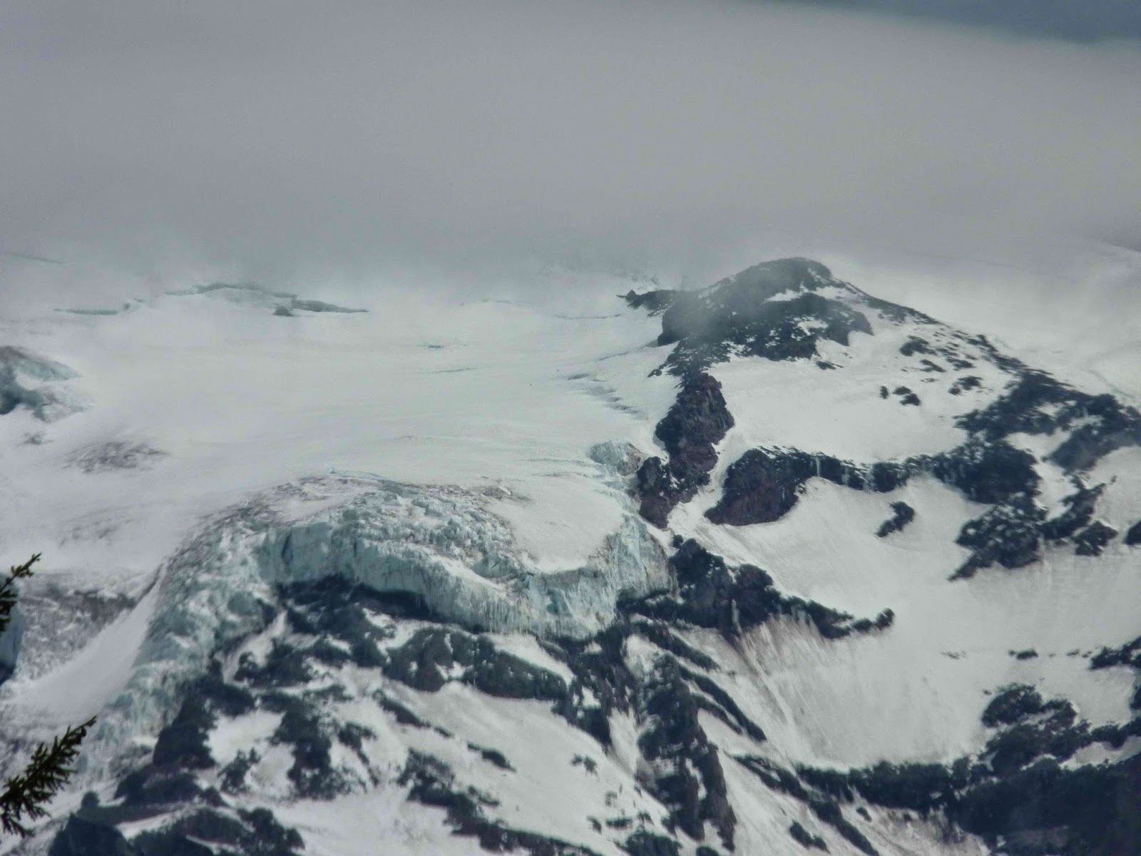
Here is a nice close up of the mountain top.
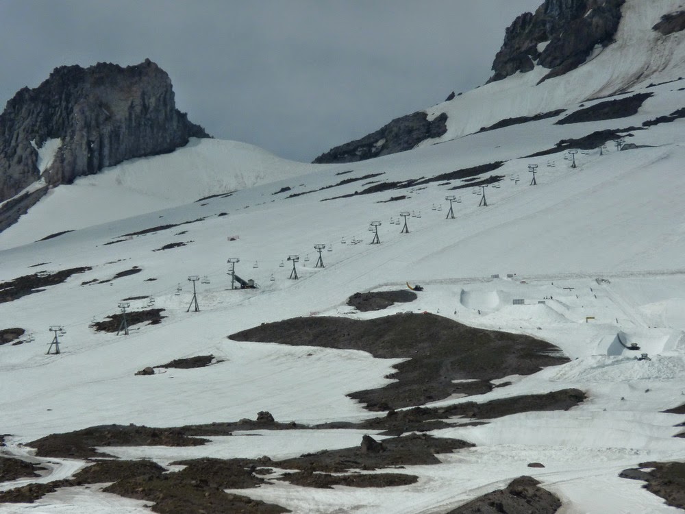
Mt. Hood is the only mountain in the continental US where one can ski year round. Apparently many competitive skiers take advantage of this for practice. The skiing is usually in the morning before the temps get warm and the snow soft. Note the chairlift.
Nice hikes around the area, of course. This one took us through a nice meadow full of wildflowers.
Yellow flowers
To the nice Umbrella waterfall
Next we headed for the Mt. Hood dam...let's think about this - a beautiful, 90 degree sunny afternoon, just 50 miles or so from Portland, OR....yulp, crowds!
But the water was beautiful
And we found the biggest Pipe Stem flower we've ever seen! it is well over 12 inches high. Wish it had been in bloom
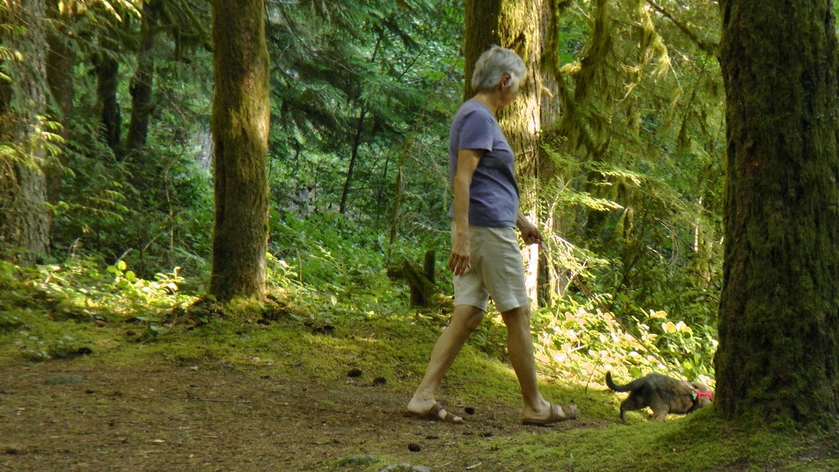
Back to the RV for a nice walk for Smoke. She loves her walks in the woods, definitely taking the lead to show me where she wants to go.
Today has been rainy, but it seems to be spotty showers. The nearby town of Sandy is having an art show/festival and the rain has stopped. Think we'll venture over there before leaving tomorrow morning for the Oregon coast.
We drove across the bridge in Hood River to the Washington State side of the Columbia. This gave us a different perspective of the river, including the train tracks that run along it. Note the train tunnel in the bottom left.
Nice view of Mt. Adams to the north.
We left our "rest area campground"
and drove the short 90 miles to the Mt. Hood area, actually only the other side of Mt. Hood Mtn. New campsite - one that we like a lot better!
The light area at the right of the above picture is the river beside our campsite.
The princess likes the new site, too.
We toured about on Friday afternoon and yesterday - the views of Mt.. Hood are spectacular from this side of the mountain.
Here is a nice close up of the mountain top.
Mt. Hood is the only mountain in the continental US where one can ski year round. Apparently many competitive skiers take advantage of this for practice. The skiing is usually in the morning before the temps get warm and the snow soft. Note the chairlift.
Nice hikes around the area, of course. This one took us through a nice meadow full of wildflowers.
Yellow flowers
To the nice Umbrella waterfall
Next we headed for the Mt. Hood dam...let's think about this - a beautiful, 90 degree sunny afternoon, just 50 miles or so from Portland, OR....yulp, crowds!
But the water was beautiful
And we found the biggest Pipe Stem flower we've ever seen! it is well over 12 inches high. Wish it had been in bloom
Back to the RV for a nice walk for Smoke. She loves her walks in the woods, definitely taking the lead to show me where she wants to go.
Today has been rainy, but it seems to be spotty showers. The nearby town of Sandy is having an art show/festival and the rain has stopped. Think we'll venture over there before leaving tomorrow morning for the Oregon coast.
Thursday, July 10, 2014
Mt. St. Helens and the Columbia River Gorge
We left Mt. Rainier and decided to make a side trip to see Mt. St. Helens en route to the Columbia River Gorge. OMG. First looks are deceiving - a glistening white mountain, clouds wafting over the top.
But by the time we reach the visitors center at the Johnson Observatory, the complete devastation of her May 1980 eruption becomes clear.
Here is a close up of the caldera. You can see the lava flow from where the top of the mountain blew off, a full 15 miles high, landing in a nearby lake.
The lava flow was 650 feet deep in places and extended for 24 miles. That is the gray "stream" running down from the mountain.
While an area immediately around Mt. St. Helens has been left "as-is", the thousands of square miles of trees downed by the flow or killed by the intense heat were replanted asap by the Weyhauser Co, who just happens to own most of this entire area. Over 2 million trees were planted. This picture is not blurred - it was taken from a complete stop - the trees are close together, all the same age, all their branches lined up, giveing a blurred appearance. I couldn't watch them as I drove. Of course, they are actively logging these forests, too. A Weirhauser representative at an overlook used the phrase "Wyerhauser, the tree planting company" --- hmmmm
Here are two videos of the explosion (not nearly as graphic or jaw dropping as the full screen one at the visitor center!!!) Not the best, but they do get the point across. Stay with the second one (the one with a song) long enough to see the eruption).
This one is from the US Forestry Dept - click below
eruption
This one is from the History Channel, with added music and the obligatory commercial first - sigh -
http://www.history.com/topics/us-states/washington/videos/mount-st-helens-erupts
Onward to a different climate, the Columbia River Gorge. Our campground is against the river, wedged between the river and an interstate rest area. Never entered a campground through a rest area before, but the state of Oregon seems to like that approach. The river and associated historic area (think Lewis and Clark) are about 100 miles long. Wonderful, but narrow, Historic Highway 30, build in 1915, runs along the water, giving great views and vantage points for stopping. The climate gradually goes from the familiar rainforests, with high waterfalls, to semi arid desert, as we head east.
Multnomah Falls - the third highest in the world. Multnomah Falls is 542 ft high - Niagara Falls by comparison is a mere 86 feet high! About 20 years ago, a bus size boulder fell from the top to the middle of the falls, sending out a 70 ft high splash that soaked (and injured) a wedding party of 13 standing on the bridge.
Next, Wahkeena Falls, 242 feet.
And lovely Bridal Falls, 139 feet. It's a long 2/3 mile hike downhill, a much longer 2/3 mile hike uphill - thank goodness and the park service for appropriately placed benches!
Bright flowers are in full bloom this time of the year in the rainforest environment.
With a 360 degree vista of the Columbia River region, Vista Point is appropriately named. It is a vista itself!
Traveling westward, we see the old lock system for the Columbia River. This old lock would accommodate one barge and her tug. Not sufficient for today's traffic, it is obsolete, always open, allowing the Native Americans who live in this region access to fishing (for salmon!). Their successful catches are generally saved for personal use, but one week per year they are allowed to sell to the general public, from tents set up against the lock. It was tempting, but the fish were whole and I am not into filleting and trying to save an entire salmon. We bought prepared fillets from a Native American shop next door.
The new lock can accommodate two barges and their tugs. Much larger, almost 700 feet long 85 feet wide, 65 feet rise. The Columbia river, along with the Snake raver that dumps into it, has 8 US Army Corps of Engineers dams, making it navigable for barges all the way to Lewiston. This is over 400 miles inland, with a total lift of 730 feet, and a controling depth of 14 feet.
The early desire for a navigable river, and then, later, electricity, lead to the building of Bonneville Dam. This has grown from one power house to two in the 1970s, plus a large spillway. The original dam and spillway were a public works project in the '30s.
The turbines are huge!
A tour of the larger power house allowed us better looks at the generators. Got to walk out to them (look at the walk way at the third one) plus a walk along the floor.
With the building of the first dam in the early 1930's came the acknowledged responsibility of not blocking the salmon migration upstream on the Columbia River. Hugh fish ladders were installed, allowing the fish to still swim upstream to their spawning areas. We actually saw fish swimming up and over these ladders. They didn't exactly make spectacular leaps like you see in the videos, but rather swim just under the water, up into the next level.
Underwater windows allow you to watch the salmon and trout swim past. These fish are counted, every darn one of them, by one poor soul. He has an 8 hour shift, 10 minute break every hour, and has to recognize 6 of the major fish that swim upstream. An appropriate button is pressed for each fish. Think that sounds hard? A record 120 thousand salmon have gone upstream so far this season, plus the assorted other fishes. whew.... (I'm betting his window is clearer than this one!)
Further westward, to the tourist town of Hood River. We plan to visit there this afternoon. As we approach our campground, the climate has changed from rainforest to arid desert conditions.
Fortunately, someone had the foresight to plant trees in the campground when it was established!
Mt. Adams is visible from our vantage point above.
Oh, almost forgot - there IS a river running through here! At 1243 miles, the mighty Columbia River is the largest river in the Northwest region of the US. At least 40% of all wheat that is exported from the US is transported down the Columbia. 14 hydroelectric dams are along the Columbia, the largest being the Grand Coolee Dam (visited last year - the one with the armed guard escorts on the tour...). The at some points and times, water flows downstream at an impressive 10 knots - we wouldn't be able to take Latitudes up stream against that kind of current! And it is a kite-surfing mecca. Hope to catch some pictures of that later today.
Saturday, July 5, 2014
Hurricane Ridge and Mt. Baker in Olympic NP and Mt. Rainier in Mt. Rainier NP
No internet or cell for days – this is being blogged as I
go, and will be published ---all of it --- as soon as I can get internet. Note - first time in 2 weeks for internet - still no cell in the national parks (and nearby towns) of WA State. We are "buying" Internet at a small dinner outside of the park by eating lunch here. Probably no cell/internet until at least Tuesday, the 8th.
Mt. Olympus sits proudly, highest on the ridge. She is the tall peak slightly left of the
middle.
On the way to Hurricane Ridge, we caught this astounding
shot of Mt.Baker in the distance, seeming to hover in mid air on the east side
of Pudget Sound.
One last drive past Crescent Lake, her clear waters over 600
feet deep. We read that you can see 60
feet down in some areas of the lake.
This glacier is hanging – high and ready to break away.
And my brave hiker…
I guess the wildlife isn’t used to visitors yet – this doe
had little care for traffic.
Our 1 ½ hour trip to reach the Sunrise Visitor Center definitely showed us how the mountain could hide in the fog.
But, as the morning wore on, the fog lifted and Mt. Rainier came back. We are looking at the NE side of the mountain today. About 10,000 try the 2-3 day climb to the summit each year – less than ½ make it. About 3 weeks ago an avalanche killed 6 trying to make the climb.
This shot shows mountain to river. The Emmons Glacier, just off center to the
right, is the largest on both Mt. Rainier AND the lower 48 states. The glacier used to flow in the dark brown
area below it. The glacial blue lake is
a result of glacier action thousands of years ago. The White River flows at the bottom, full of
glacier melt.
This Pasqueflower has “hair” to protect it from the bitter,
high winds. Doesn’t deter flies, though!
And animals… chipmunks work the area, feasting on the new
berries.
Yesterday, on the 4th, we did a couple of waterfall walks. With our absence of internet, I don't believe you'll be seeing pictures of them LOL!
Mundane chore of laundry today -but it is done! CLEAN sheets! whoohoo! Next, back to the RV for a campfire and long walk for Smokey.
Hope the 4th was a good one for everyone!
With just one day left to explore the remaining sections of
Olympic National Park, we left early and saw a lot! First, Hurricane Ridge. It is an amazing ridge of mountains,
including a view of Mt. Baker many miles to the east. The ridge is so
long that I can’t put a panorama of it in this blog. Had to cut the picture in half. Here are, from left to right, both portions
of Hurricane Ridge.
The high meadows are green, filled with bright wildflowers,
and grazing deer.
From the other side of our vantage point, you can see just
how high the road climbs to view Hurricane Ridge. This view is as beautiful, showing off
Olympic NP in all of her spring glory.
Fabulous waterfalls are everywhere, especially in the rain
forests.
I rather regretted leaving our beach front camp site, but
off we motored on Tuesday morning, making our way to Mt. Rainier NP. Mt. Rainier – wow.
Mt. Rainier NP is a huge square which surrounds Mt. Rainier. Mr. Rainier herself is like a flower with 25
petals flowing down from her high peak (14,410 Ft). Each petal is actually a
glacier. Mt. Rainier NP has more
glaciers than any other national park in the continental US. This particular glacier is
flowing – you can
see some of the characteristic blue ice in it.
We were extremely fortunate to see Mt. Rainier on a clear,
blue skied day. We were told that many
visitors never see the top of the mountain, and we see why – clouds curled
around the mountain top from time to time.
Although it is July, 90% of the trails are still snow
packed. Here is the Paradise Visitor
Center, at a mere 5,400 feet.
And this little pika (about the size of a large mouse)
wasn’t sure if he should hide from us or not.
That white mass behind her is snow…
Again, wildflowers are abundant. We especially like the Avalanche Lilies. They are the first flowers to pop up through
the snow each year, usually in an avalanche area.
Rosey Spirea make bright spots.
Other flowers cling to sheer rocks.
Areas of volcanic flow are slowly being covered with
mosses, lichens, and tiny wildflowers, Mt. Rainier watching in the background.
Thursday, July 3
We awoke to the soft sound of rain, left in a mist, and
arrived in the far northeast section of Mt. Rainier NP in the fog at 6,400 feet.
Our 1 ½ hour trip to reach the Sunrise Visitor Center definitely showed us how the mountain could hide in the fog.
But, as the morning wore on, the fog lifted and Mt. Rainier came back. We are looking at the NE side of the mountain today. About 10,000 try the 2-3 day climb to the summit each year – less than ½ make it. About 3 weeks ago an avalanche killed 6 trying to make the climb.
No one bothered to mention to us that today was actually the
first day of this season that the Sunrise Visitor Center was open. Too much snow earlier in the season (it IS at 6,400 feet….)
Flowers don’t care about snow. As we visit different areas of the park, we
see the roadsides and fields filled with different flowers. Tiger Lilies!
And finally!!!!! A
elk!!! He is standing almost belly deep
in a marshy stream, happily grazing on grasses near the top. He was beautiful – and large.
Luke took one last walk today while I sat it out. Rainforests are also in the park, filled with
old growth and massive trees. Here are 2
of the oldest trees (over 1000 years old) and largest of the forest – Douglas Fir.
An example of the “nurse log” that I mentioned earlier. This nurse log is in a much earlier stage of
the development – the trees growing on top of the log are younger, with small
roots only beginning to crawl across the nurse log and work their way into the
ground below.
Yesterday, on the 4th, we did a couple of waterfall walks. With our absence of internet, I don't believe you'll be seeing pictures of them LOL!
Mundane chore of laundry today -but it is done! CLEAN sheets! whoohoo! Next, back to the RV for a campfire and long walk for Smokey.
Hope the 4th was a good one for everyone!
Subscribe to:
Posts (Atom)