Thursday, July 27, 2017

On a lobster pound crawl with Ange and Ray

Friends from Fl arrived and we all started exploring.  First, a day driving northward, looking at the coastal Maine towns, and searching for lobster pounds.  Lobster pounds are places where you can buy either fresh lobster or lobster meals.  They usually include picnic tables for outside eating.  Often, customers bring their own adult beverages.  We passed a truck selling lobsters on the side of the road -  nope.  Then a couple of promising pounds in the seaside town of Lincolnville.  THEN we found the perfect place, in Belfast.  We've been to Belfast many times, but never to the opposite side of the river. That is where Youngs Lobster Pound is located.


Ange and I couldn't resist having our picture taken with the "lobster bear"


Tanks, tanks everywhere, full of lobsters.  This picture is of one side of the pound - the other has just as many tanks.  That large ladder in the center goes up to a big dinning hall, just in case you aren't a true Mainer and don't want to eat outdoors. (note what both men in the picture are doing....)


The "working" tank where you pick your lobster is brimming with lobsters.


The working area behind the tank.


There is also the counter where you order your cooked meal.  Didn't get a picture of that.  Maybe next time - we definitely want to go back and eat, hopefully while Ange and Ray are still here.  We had just had a really good haddock and chips lunch at a little diner in Belfast. Ray said their goal for this trip is to eat lobster and blueberries!!

In the back is an outdoor dining area, plus a dinghy dock. Luke and I will be able to zip right over the next time we're in Belfast.


On the side of the shop, each A/C unit has workers gloves drying in the warm air.


Just past Belfast is Ft Knox and the Penobscot Narrows Bridge and Observatory.  Built in 2006, one of the towers has an observatory at the top.  The towers are high, 437 ft, over 140 feet taller than the Statue of Liberty.  An elevator whisks you to the top in less than 1 minute.


Borrowing from Wikipedia, the bridge was "constructed recently using a cradle system that carries the strands within the stays from bridge deck to bridge deck, as a continuous element, eliminating anchorages in the pylonsEach epoxy-coated steel strand is carried inside the cradle in a one-inch steel tube. Each strand acts independently, allowing for removal, inspection and replacement of individual strands. The cable-stay system was designed with a system that uses pressurized nitrogen gas to defend against corrosion.
In June 2007, six reference strands within three stays were replaced with carbon fiber strands – a first in the US. Monitoring on the strands will evaluate this material for future use in bridge designs"
If you want to read more about it,visit 

Ft Knox is also located at the Penobscot Narrows.


During both the Revolutionary War and the War of 1812 British ships entered the Penobscot and claimed the area.  The USA decided some defense was a good idea and by 1844 had started the massive fort.  The fort saw only 2 periods of military activity, the Civil War and the Spanish-American War, but no enemy ships ever entered the Penobscot during these periods.
Last stop of the day was Castine, home of the Maine Maritime Academy. No lobster pound on the dock, but we did find ice cream and the Dyce Point lighthouse.


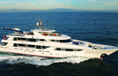
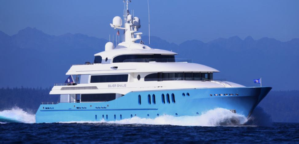
The next day we took a sailboat excursion along the coast to see the towns from the water.  Latitudes is a lot slower than the car, so we only got as far as Camden.  As Luke and I took Latitudes to the dock to pick up Ange and Ray, we spotted (couldn't miss....) Evivva on the dock.  This is the yacht with the helicopter.  Got a good picture this time.


It was a sunny, calm day and we took full advantage of it.  Our guests took much of the ride on the bow of the boat, great for taking in sun and postcard perfect pictures.  First, Ray.


Ange and I had to get in on the act, too.


The background here is the Rockport harbor.  It has a cute little park with a lobster pound and the town climbing up the hill behind it.


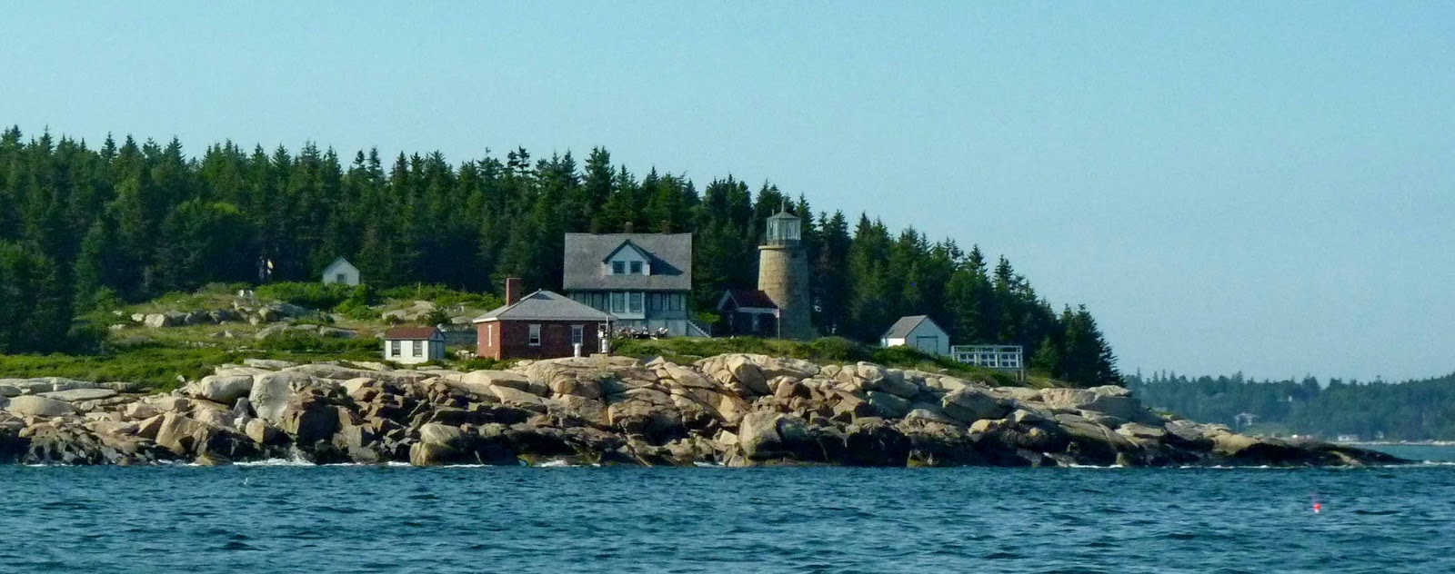
Her lighthouse, the Curtis Island lighthouse, is quaint, too.


Camden was next, her harbor full of beautiful old sailing vessels.


We anchored for lunch and then slowly made our way back to Rockland.  Very slowly, as the sun was in front of us and the wind had picked up. Both of these made it much more difficult to see the lobster
floats.  But we didn't snag any of them!  Ange caught this picture of us leaving the dock after dropping them off.  Luke is at the helm and I am  cleaning up the dock lines and such. It was actually a very tricky maneuver to get away from this "U" shaped dock with the wind (gentle, fortunately) blowing us into it. We used a forward spring line, and volunteered Ray to hold the bow off the dock as we pivoted the stern away from the dock. 

 
Today is very windy with scattered showers. We are anchored out, relatively sheltered, riding out the day.  More exploring tomorrow.

Sunday, July 23, 2017

Catching up

We tried to leave Rockland, thought we’d been there long enough for this stay.  Yes, we tried – the sky had been foggy, but the fog lifted, we could see across the Penobscot to Vinalhaven, so we left for a destination 8 miles out.  3.5 miles later, we turned around in dense fog and carefully plotted out way back home, fog horn blowing.  We watched all day for another opportunity to leave, but the fog hung relentlessly over the waters.  Rockland was sunny, but it was clear that the bay was not!


Smoke was delighted to be back at anchor after such a short trip.  She always runs to the bow of the boat after we anchor for a rub fest.  It was Luke’s turn.  Now, this is a shot of two happy boaters. 


Look carefully, though, at Smokey. Head thrown back, she is about as happy as she can get.


This strange plane flew overhead, apparently going to Owls Head Transportation airfield.


We have seen the super sail boats this trip.  First, the Salpertron sailboat, 145 feet, that blew past us.  A mere $18M.


Then the superyachts.  These are not charter yachts;  just for personal use of the owners.
As we sat at anchor in Boothbay Harbor, the world’s largest production superyacht, Evviva, passed so closely we could almost touch her (waaaay too close).  Her owner, the founder/owner of Bayliner Yachts, has built 4 more of them and is happily awaiting the order for number 5. A helicopter sits on top of this 164 foot yacht. A mere $23M.


A little about her, plus clear pictures...

http://www.superyachts.com/motor-yacht-7468/evviva.htvvm


Next, the super yacht, Silver Shalis, is owned by the fellow who owned the Twin Towers in NYC. Seems he took out terrorist insurance 2 months before 9-11.   Then, with the two airplanes flying into the towers, he claimed two attacks and collected almost $5B (yulp, billion).  THEN he got the contract to build the 7 World Trade Center!!  She is a paltry 179 feet.  A mere $7M, perhaps because she is older, built in 1987.  The rest of these yachts were all built in the 2003 – 20013 range.


But I don’t think we’ll surpass this one.  She was cruising up the Penobscot as we left Rockland.  This 370 foot monster is one of the worlds largest private superyachts.  Built for a telecommunications exec, Le Grand Bleu was sold to the 151st richest man in the world, a 50 year old Russian billionaire businessman, investor, and politician.  Besides being the chairman of a major wealth management firm, he owns the Chelsea FC football club in England.   Le Grand Bleu has a 74 foot  sailboat on her deck!  Plus a 65 foot speedboat!  Look at the tiny lobster boat in front of her.  Whew. We let her go first….


 I am very positively impressed, however, with  her attention to being “green”.  The ship received the Environmental Protection Notation from Lloyds of London.  She has sewage and wastewater treatment plants aboard, a water purification system, and nitrogen and sulfer exhaust controls. A mere $90M (the owner, by the way, has at least 2 other superyachts, valued at $120M and $140M. Guess you can do that when you’re worth over $13B)

An 8 mile sail and we arrived at Hurricane Island.  This used to be an Outward Bound School’s summer sailing program  island, but that was closed in 2006.  The Hurricane Island Foundation is there now.   We picked up one of the guest moorings and took the dinghy about a mile to the beautiful White Islands, a tiny archipelago of 6 islands.  This is touted as one of the most beautiful Maine island groups.  Big Garden Island was previously owned by Charles and Anne Lindbergh.  They donated the island to the Nature Conservancy.

Clouds above Little White Island


We landed the dinghy on Big White Island.  Luke has perfected a pulley system for the dinghy.  A few ropes, shackles, pullies, and bingo, we can drop an anchor in the water, secure an anchor on the shore, and use the ropes to take the dinghy out into the water and bring it back again.  No more dragging the heavy thing and it’s even heavier outboard back across a rocky shore to the water after a falling tide.


This is a pan of the landing site of Garden Island.  It’s  very rocky.


These islands have everything.  Lush green grass


Trees that cover the interior of the islands


Here is a great long view of the islands.


Back at Hurricane Island, the inevitable fog came rolling in. 


The next morning we took the dinghy over to Hurricane Island to explore the trails.  Back in 1874 the island was home to over 1200 Irish and Italian immigrants working in the granite quarry and doing the fine finishing on work done on other islands.  The 125 acres island had a post office, 6 boarding houses, 40 cottages, pool hall, bowling green, a bandstand, a company store, and 2 major quarries.  But it all ended abruptly in 1915 when the Superintendent of Works passed away after 20 years at the island.  It was announced that the goods from the company store were being moved to the mainland.  This caused a panic and most families took the last scheduled boat to the mainland, leaving behind most of their worldly possessions.  The thriving town became a ghost town overnight.
There is a really good history about this period, plus pictures found at www.hurricaneisland.net, then go to "history".  There is still a lot of rusting equipment around the island.  The largest is the fly wheel.


The quarry – love the “no swimming” sign.  Obviously, seagulls can’t read.


Here is an overall view of the quarry


Old stones show where the cottages and other building stood.


The ice pond is beautiful.


We walked to the “sunset view” summit.  You get a wonderful view of the White Islands from here.  The wisps of the morning fog are still lingering in the trees.


After lunch we left for a night at Seal Bay, passing the Heron Point lighthouse.


Seal Bay is well named!  These fat rascals have been basking in the sun atop one of the rocky ledges.  It took us a few minutes to figure out the first fellow – his head is closest in the picture, brown snout upturned, and fins wrapped around his body as he relaxes on one side. The others are obviously enjoying the sunny day also.


After a lazy day at Seal Bay, we plan to head back to Rockland to meet our Florida friends.  No internet here, so I am preparing the blog to post when we get back to civilization.


Tuesday, July 18, 2017

Repairs and "a lobster man and an old sailor lady walk into a laundromat..."

First, repairs.  Boy did we get them done!  The most important one was checking and ultimately replacing the wind indicator on top of the mast.  This worked intermittently when we first set sail this summer but finally just died.  Luke ordered a new one and we both decided that it was just as well to have the marina send someone up the top of the mast to check and repair it.  Luke has gone up the mast  about 6 times over the years, and believe me, being hoisted by a rope to the top of a 59 foot mast is not fun. We don't have spare halyards, (ropes that run to the top of the mast to haul up sails) so we first have to replace the topping lift line (a smaller rope that supports the aft end of the boom) with a heavier line, and even then, Luke can't get to the front of the mast at the top. With a bag of tools and new anemometer, the fellow from the marina is standing on the deck of Latitudes, preparing to be hoisted by a crane on the dock. That "bag" in his hands is the bosun's chair, a swing like seat, that he'll use to go up. (note - fog)


And up he goes!  The hoist doesn't do everything; the lucky climber gets to help climb, holding on to the mast with his legs, etc.. If you can see the little "sticks" on the very, very top --- that is what he's going to work on.


It was a successful effort.  The anemometer was repaired, wires were checked, miscellaneous nuts and bolts were tightened, etc.  The wind speed indicator works and we are comfortable about the condition of the rest of the mast connections.

Over the next 2 foggy days - too foggy to leave Rockland - Luke replaced the old gas can in the dinghy with a new one.  It looks like the old one is deteriorating. This was an easy fix!


The long fix was the shower sump pump, located under the floor boards.  The shower drain is below the water level, and rather than letting the water drain into the bilge, the sump pump is supposed to filter the water from the front shower and divert it overboard. Ours was just running over and into the bilge.  Just a simple box, about the same size and shape as the old one, a few screws and electrical connections.  Yulp, plus a lot of tools and work!  Plus contortions to fit into the work space. Working on a boat is always fun. Luke spent most of the afternoon on this while I did laundry and a few town chores.


So - the lobster man and and old sailor lady walk into a laundromat - sounds like the beginning of a great joke, doesn't it!  Actually, the young lobster man struck up the typical laundromat conversation and I learned a lot about lobstering. He was not working today because of the fog. again.  I didn't think anything stopped them from going out.  He is the "stern man" on a boat owned by an older lobster man (the owner gets to drive, etc, but they both do a lot of physical work).  Lobstering isn't going too well this season as the fog, cool weather, and lack of sunny days has kept water so cold that the lobsters aren't shedding their last year's shells  and they aren't moving offshore into the colder, deeper water.  We thought there are a LOT of pots out this year and we were right - all of the local lobster boats are putting their 800 pots each near the shore and in the harbors instead of working slowly further offshore.  They go out 2 times per week, checking 200 pots each time.  Three pounds of lobster per pot is average, but they are running about 1pound this season.
Most lobstering is seasonal, but a few go out all year.  Winter lobstering is totally offshore and requires a larger boat, some real weather tolerance, and is just simply rough.  Plus, the state issues only a few new year round licenses each year.  And they cost $55,000!  You only have to buy it once, but there is a lower renewal fee each year. He did say that the initial cost can be offset by the winter catch in just one winter.
I asked him why they put the lobster traps and the associated floats EVERYWHERE instead of leaving them out of the boat traffic channels in and out of harbors, etc.  He said, eh, we just put them wherever.  Gotta go somewhere.  I asked if they don't lose a lot of them when boats run over them.  He said nope, that just doesn't happen.  Then he explained the physical lobster trap set-up.  The trap sits on the bottom, with a line that goes to the top of the water with the bright float attached.  This line is actually made of 2 separate lines.  The bottom is a non-floating line which is heavy and in low tides basically sits around the trap and helps keep it from moving.  The second line that is attached to the end of that and goes to the top of the water is a floating line.  If the lobster float gets cut off by a boat engine (or desperate boat owner) the line just continues to float, top edge at the top of the water.  With GPS coordinates of every pot, the lobster man easily finds the location of the trap and can retrieve his line, attach a new float, and is all set to go again.

Then there was the lady from Asheville NC with an RV identical to our old one.  She was fun to talk with and compare RV notes and places to go.

Then there was the cab driver who said that he traced his first relative who came over from England.  The year was 1610 and the relative was a 14 year old boy who was sold by his uncle into slavery to the British Monarchy to go to America to help colonize.  He literally came off the boat in chains, a slave.  The landing place was James Fort, late know as Jamestown, VA.  When Europeans came back a year later to check on the little colony, everyone left but 1 person had died of disease.  The wayward relative had run off earlier with someone named Rebecca and was spared the disease.  Makes an interesting story.

It was an "educational" day :-)  Now if the damned fog would just finally lift, we could leave here for a few days and see more of the Penobscot.  It IS supposed to be better tomorrow.  Fingers crossed.

Sunday, July 16, 2017

Port Clyde and Dix & High

After waiting out the cold, windy, and intermittent rain in Five Islands, we left in beautiful skies on Friday, heading for Port Clyde.  Port Clyde has the ferry to Monhegan, a small market, restaurant, church, ice cream shop, and a couple of art galleries. Not much else.  But it is a pretty little harbor.


Don't be mistaken - this is very much a working harbor, too.


Speaking of working....we noticed floating "bales" of something in the water.


It turns out that a company is harvesting seaweed in an agri-business - for the past 20 years!  Here is the "harvester/ baler machine"


Pretty typical Maine houses line the waterfront.


I have to admit,though, if I lived here, I would really love a home on an island!


We did spot this nice Black Crested Night Heron on the dock.


Leaving Port Clyde yesterday, we passed the Marshall Point Lighthouse.  This beautiful lighthouse is best know for it's roll in the Forrest Gump movie.  This was his final stop during his run across America.


As we sailed towards Rockland, we passed a couple of lighthouse - the Franklin Island lighthouse, en route to the islands of Dix and High, about 8 miles east of Rockland.  This lighthouse marks Franklin Island, a Maine Coastal Island National Wildlife Refuge.  We would love to go there sometime.


Also, the Whitehead Lighthouse.


Finally, we anchored between the islands of Dix and High.  It was a beautiful, sunny day.


But a little different when we woke up this morning!


This misty fog gave way to fog so dense that we couldn't see any of the islands!  SO, we sat.  And waited.  After a few false starts, the fog finally diminished enough that we felt safe in starting for Rockland.  The sky continued to clear and it was a good passage to Rockland.  Fresh water in our tanks, a bit of the Rockland Blues Festival, and we are at the dock at our winter marina.  Tomorrow they will climb our mast and see if we can find the reason for the failure our wind speed indicator.