There is a lot of the Monument Valley, at the end of the gray asphalt road --- looks sort of like going to Oz, doesn't it.

A couple of the major formations in Monument Valley


En route, we passed Mexican Hat, both a one-horse town and a more impressive rock formation.

You know you're in the desert when you get dust devils. This was one of several at the same time.

You know you're in Native American Tribal Land when you see road signs like this.

As we neared the entrance to the Grand Canyon, we begin to see Native American road side stands selling jewelry. Most were located at pull-off or rest areas. We didn't stop at any until we were almost at the park. This was an overlook, preceding the actual Grand Canyon lands, that was open to the public on a contribution basis. The vendor stalls have seen better days. Only a couple of stalls were actually open. Perhaps it's busier in the high tourist season.
At the Navajo overlook, we did get our first impressions of what was to come - big canyons!

The Colorado River runs through the Grand Canyon, muddy in most places. You can see a little of it here.

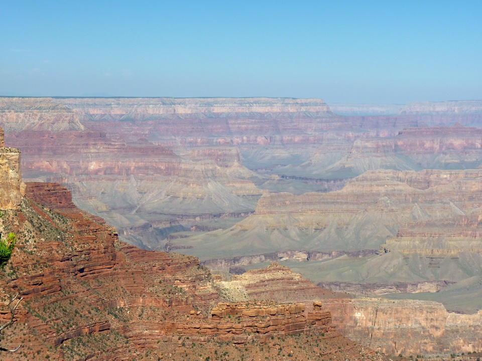
Finally, the GRAND Canyon! The explorers have arrived.

Up to 18 miles across, 277 miles long, and a mile deep, the Grand Canyon is incredible. Here are some pictures. No matter how good, they can't begin to capture the grandeur. The colors of the canyon change with the sunlight


And now meet Miss F3 - a California Condor living in the Grand Canyon! Luke saw her and caught this great picture. I missed her... poo...

The condors were almost extinct in 1992, down to 22 birds. The decision was made in 1993 to catch all wild birds, breed them, and re-establish them. It was successful! Over 70 are now in just the Grand Canyon. For a really interesting story about the project, click the link to condors (click on the word "condors" and it will/should open the link). Anyway, we could learn that F3 is a female, bred in captivity, and is 5 years old. You can't read it in the blown-up blog picture, but this bird has the "F3" painted on the top of both wings.
Up at 4 a.m. this morning to catch the 5 a.m. bus to a point for sunrise pictures. We're nuts... It was worth it, though. The golden glow of sunrise made the canyon even more beautiful.

By 7:30 we were headed down the South Kaibab trail. This is a trail that goes down 7 miles into the canyon itself and crosses the canyon. One can spend the night in a ranch on the canyon floor. Not us! Look at the initial trail down into the canyon...you can see 5 switchbacks and steep walkways if you look carefully.

We opted to stop at a 1 mile walk, about 500 feet down into the canyon, at Ohh Ahh Point.

Aptly named, this is the first spot where you can see both east and west into the canyon.

The bus driver told us that it would take us 2 steps up for every 1 step we took going down. He was right. Almost to the top, we encountered a mule train taking supplies down to the ranch in the bottom. They get right of way! And by the way, they leave quite a "trail" behind them... pewwww...

Back at the top, one more view, and I'll quit for today.

Tomorrow we plan to get up again too early and take the bus to the west end of the south rim for sunrise again. Then we'll stop at all of the overlooks and take pictures for several hours. Only about 1/2 of the park is open to personal vehicles. The rest is via compressed natural gas propelled buses. They are great. This bus map (again, clip on the underlined words "bus map" and the link will open up) gives a great over-all view of the Grand Canyon and how to get around. We "live" in Trailer Village along with 400+ more happy campers. We have explored the blue and yellow bus lines. Red tomorrow!
No comments:
Post a Comment