No internet to speak of in Joshua Tree - we are now in Las Vegas and I am catching up the blog and will do the Las Vegas blog before we leave here ---
--------------------------------------------------
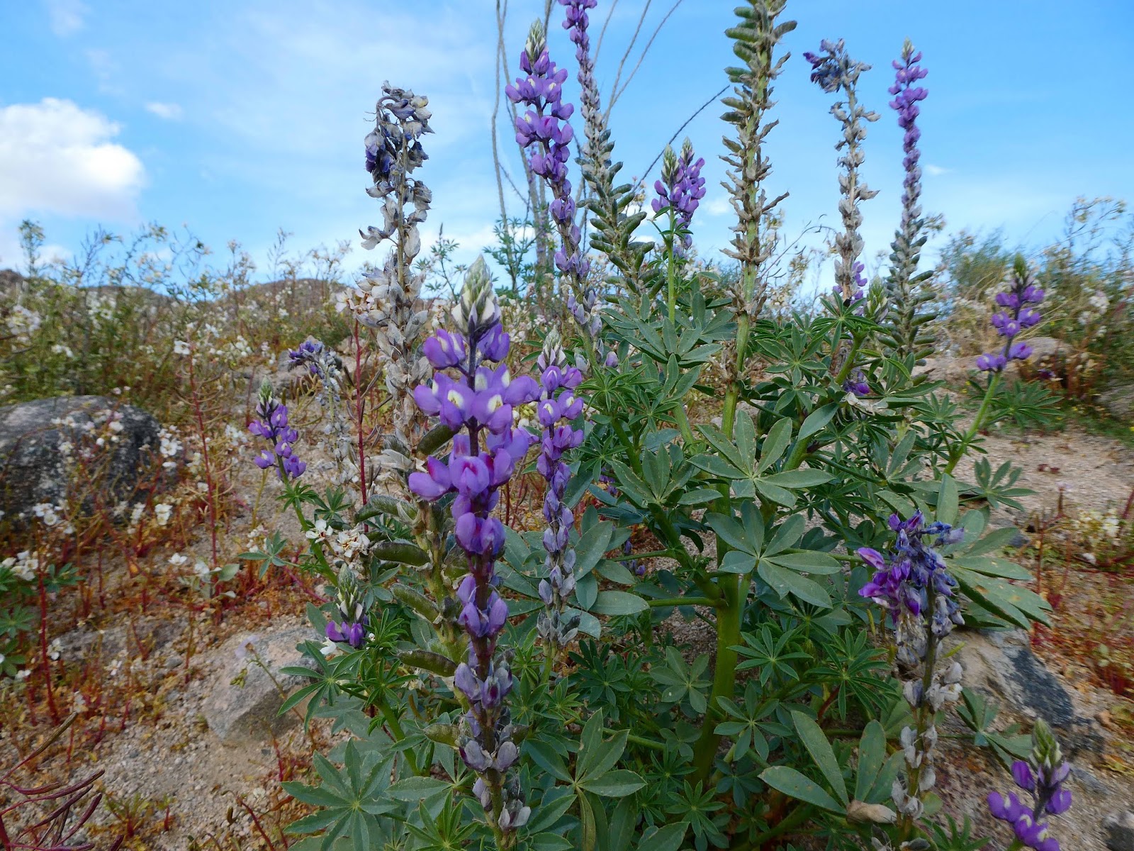
That rain we got at Joshua Tree NP created a super bloom for
the wildflowers in the desert! We had the incredible luck to be there for it. You’ve
heard that a picture is worth a thousand words?
Here are several thousand words!


From Joshua Tree we drove to Death Valley NP. We are nearing
the park…

With 3.1 million acres of wilderness, Death Valley NP is the
largest NP in the US outside of Alaska.
It is also the hottest place in the world. A record high of 134 degrees F has been
recorded. Average highs in the summer
months are in the 120’s, with night temps sometimes not dropping below
100. That’s why we’re here now, early
March. Our highs have been upper 70’s,
lows in the mid 50’s.
The wind had picked up and was creating quite a dust storm
across the desert floor.

After getting settled into the campground, we decided to do
some exploring. We were surprised to
learn that most of the side roads were closed!
It turns out that the day before Death Valley NP had received ½ of their
annual rain amount in 6 hours!
EVERYTHING flooded! Death Valley
gets almost 2 inches of rain per year. They had received .8 inches. One road to
Badwater Basin was open but none of the drives off of the road were open. So,
off we went to Badwater. Badwater
received its name when a miner couldn’t get his mule to drink from the
lake. So he decided the water was poison
or bad. Actually, it is just salty. It is also 282 feet BELOW sea level! This is the lowest point in North America.

Take a careful look at the mountain behind the boardwalk
into the lake. See the small white box
towards the upper middle-left side? That indicates sea level.

There is little water in the lake now.


The salt chunks are large, too, about the size of my hand.

This mountain is on one side of the lake
and the valley. Ages ago there was a
tectonic split that caused one side of the land to rise and the other side to
lower. The lowering side eventually
developed mountains, creating the valley we know as Death Valley.


Here is Luke standing by the 2 wagons and water tank for
size reference.

There was and still is a lot of borax to harvest and
refine. All of this white is borax.

Next we climbed on the sand dunes.

The nearby dunes contain a few creosote bushes, but as the
14 miles of dunes goes further into the valley, the bushes disappear and the
dunes grow larger, some as high as 100 feet.

See the sweeping fan of mountain at the bottom of this
ridge? This is a example of an Alluvial
Fan. The fan is caused
when water erodes the mountain side, forming a gully or canyon. The eroded rock and sand is deposited in a fan shape emanating from the mouth of the canyon. Heavier material stops moving nearer to the canyon or gully, the lighter material goes further. The net effect is a "fan" of deposited material, much like a river delta. The many
alluvial fans found in Death Valley are considered some of the best examples in
the world.

Death Valley has a lot of offer, including a volcanic
crater. Not a caldera, but a crater
created 2000 years ago when a massive volcanic explosion was caused by magna
mixing with an underground spring. The
resulting Ubehebe crater is over 600 feet deep and one half mile wide.

Last thing for the day was a walk to the top of the
Zabriskie Point overlook. Rock folds…

Chocolate topped mountains

And the golden colored badlands.

On Saturday, we checked the Visitor Center and learned that
3 roads had opened. Off we went!! (along
with every other Saturday visitor to the park).
Our first stop was the Golden Canyon trail. These trail takes us through
those beautiful golden colored badlands we saw from the overlook the night before.


Death Valley’s red rocks are visible from the trial.

The next open gravel road was to a hike to the Natural
Bridge. This was a bit more of a climb
with an elevation gain of 185 feet from the starting point to the bridge.

Here is the bridge


This breathtaking viewpoint is over 5200 ft about Death
Valley. THIS is the valley and salt
flats of Death Valley. A most wonderful
end to our visit here.

No comments:
Post a Comment